Sunday, August 16, 2020

Cuberant Lakes, Uinta Mountains, UT

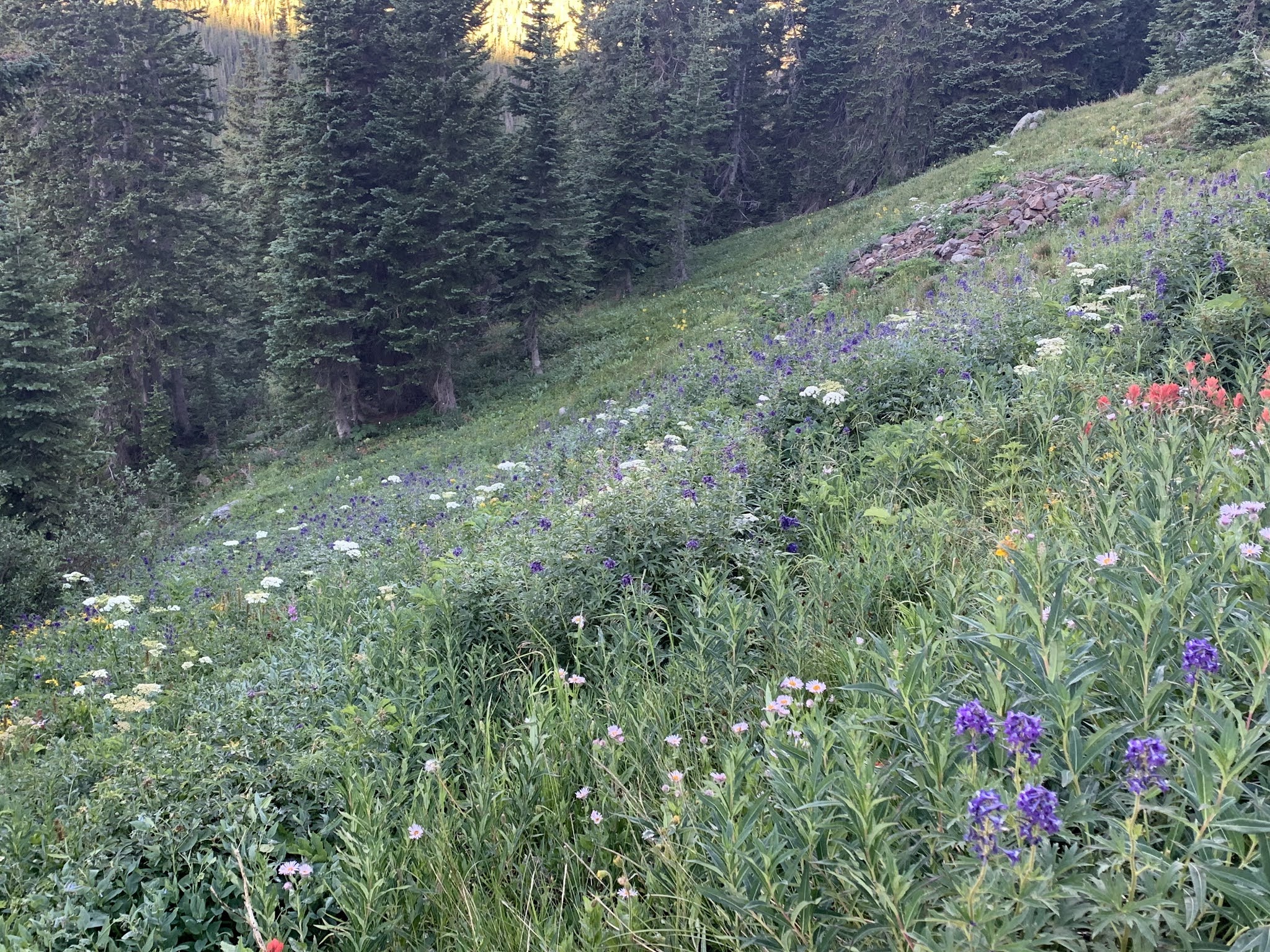
Sue and I needed an easy hike to recover from Lamotte, so we chose to visit Cuberant lakes from the Pass Lake trailhead.  It's a fairly short hike and doesn't have much elevation gain, but as you can see below it was a bluebird day and the flowers are still out in the high country.


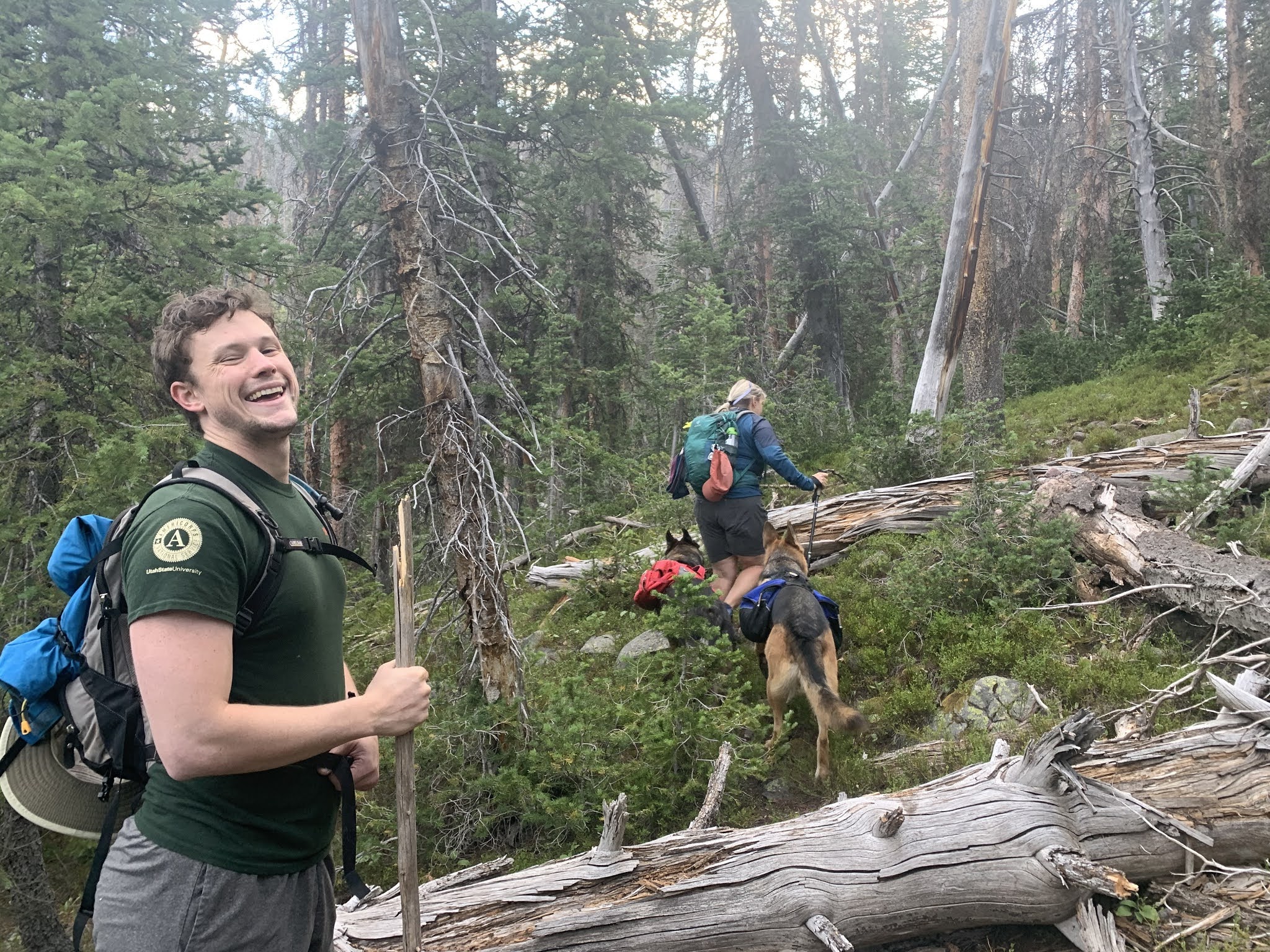
In some places the trail is lovely and invites one to stroll and contemplate the beauty all around.  In other places, as you'll see later, you'd better be watching your feet or the trail might just give you a black eye!


This is a spot with great memories for me.  Years ago when we hiked this with our family, Zack kept running and jumping across this little stream, not at this nice bridge...


... but right about here.  He made it every time!


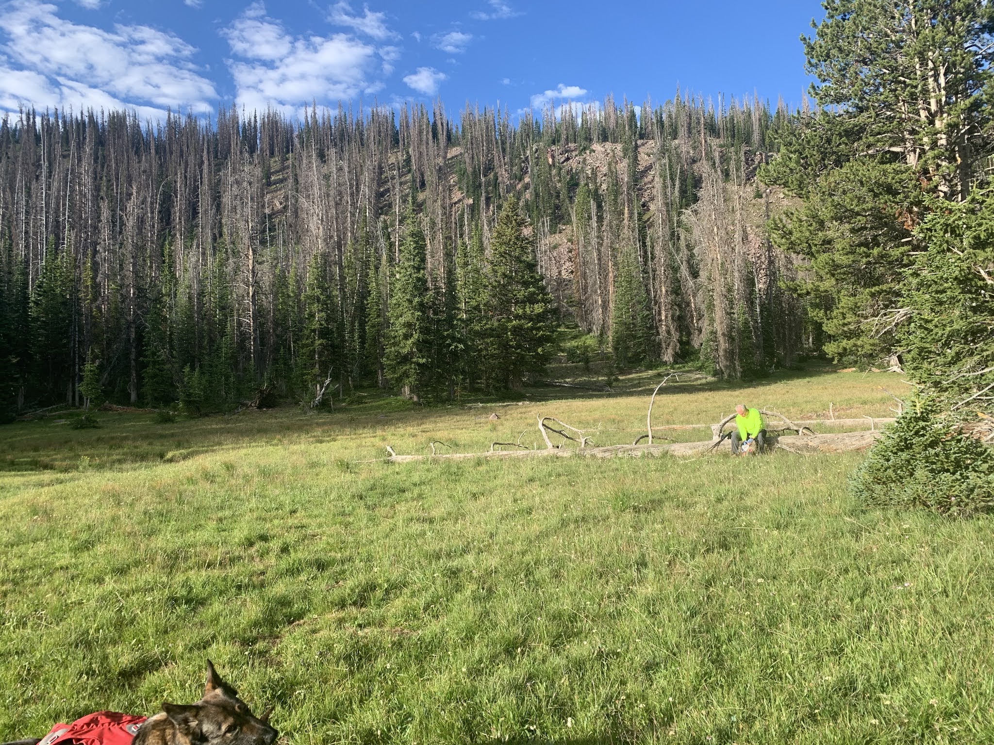
Soon the trail climbs steeply over a small ridge and at the top you can see where the lake isn't. That's not it in the green meadow at the bottom.  The lakes are down there and then up again to the right.


The first lake is this beauty with a carpet of lilly pads at its far end, with good looking trout prowling about under cover.


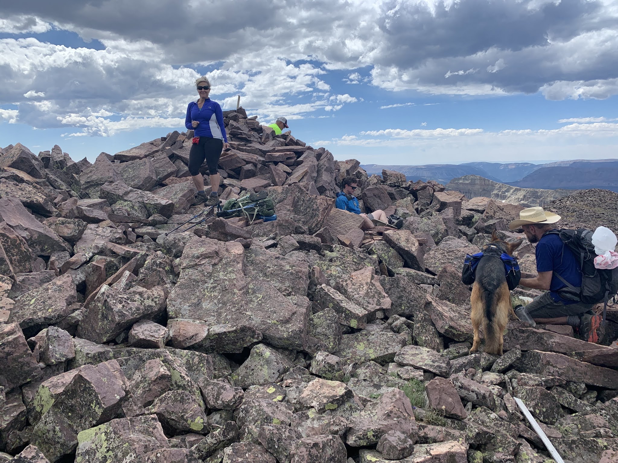
And this was our destination, Cuberant Lakes Number 4.  I took my fly rod along and spent about an hour fishing.  The trout weren't liking what I was showing them, but I had a great time practicing my casting.  Sue and Grizz went off adventuring to find the other lakes in the area.


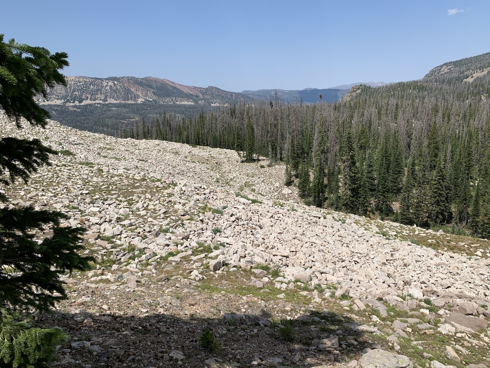
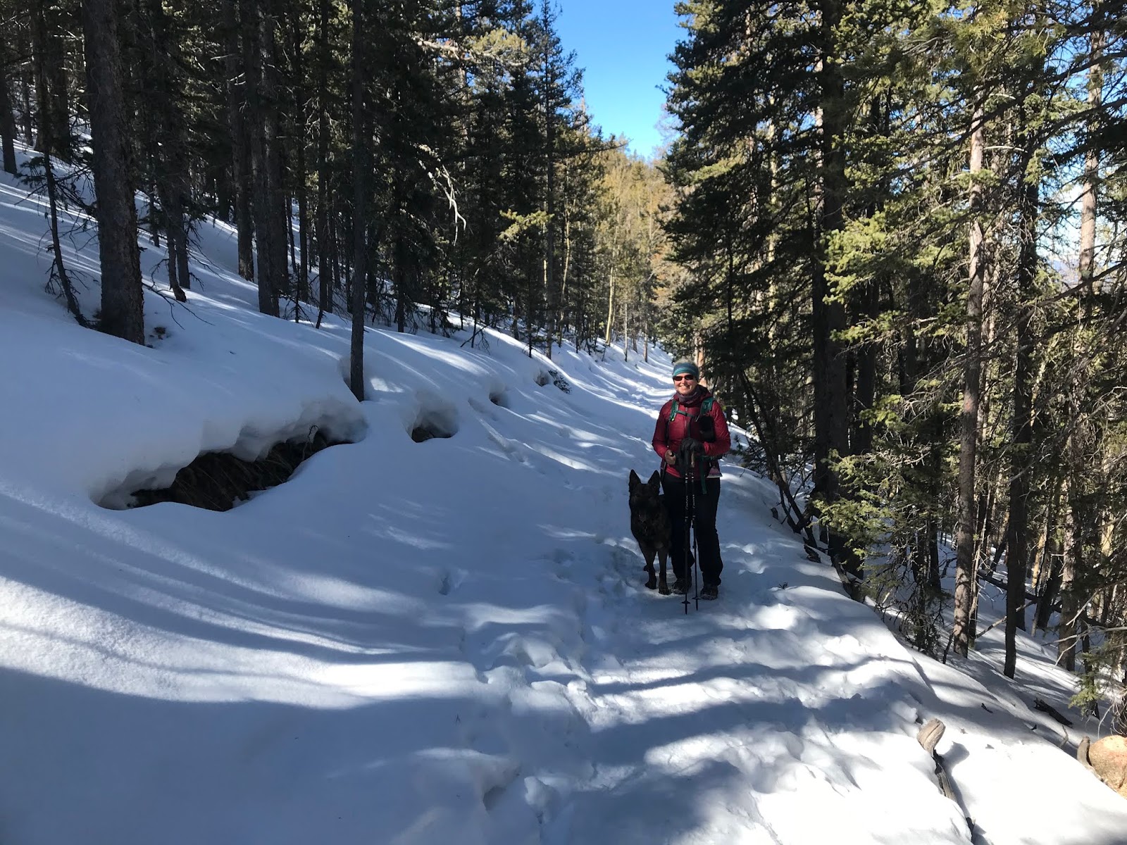
So here's the other kind of trail that might give you a black eye if you're not watching your feet.  Notice Sue...no knee brace....and....NO HIKING POLES!  This was a steep, rocky descent and she had enough confidence in her knee to do it unaided.  That was a big step for her and made her really happy.  She's even stopped carrying her knee brace in her pack.  Less than a year out from surgery.  Surgeons and Physical Therapists ROCK!!!


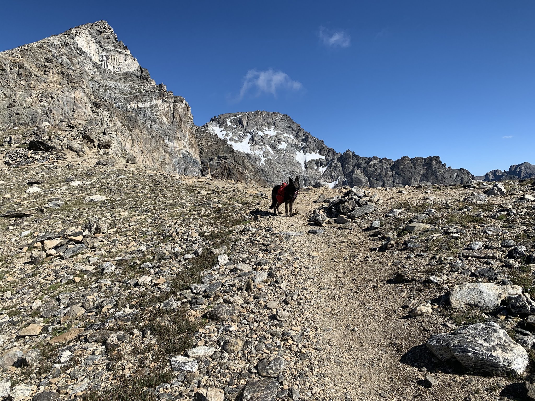
They don't call these the Rocky Mountains for nothing!


We had a great day, saw the loveliness of nature, and rekindled fond memories of a favorite trailhead and hikes with our kids.  What a wonderful life!


Monday, August 3, 2020

National Summit Day: That's a Lamotta Hike!!

It's been a year since my stunning defeat on Lamotte Peak (defeat because when I FINALLY got above tree line, I was so tired that I was grateful for the thunderstorms that had built up on all 4 points of the compass (and were threatening to electrify my day) because they gave me an excuse to not go any further <as if I could have...I was fried>{and maybe about to be fried}.[..anyway, I didn't make it].  Sue was a good sport about not summiting that day, as were Kent and Renel.  So I staggered back down vowing to be more prepared this year and not be turned away again.  With that in mind, Sue and I actually set up a training schedule, *gasp* to get ready.  I was walking several times a week after work doing BFR training (more on that another time, maybe), and we planned out several hikes on weekends and flex days to get us ready.  We made those hikes happen and they were wonderful on their own account.  We increased distance and climb, and most of them were above 13,000 feet.

At the last minute we invited Paul to join us and he happily accepted, and Kent and Renel talked their son Miles into it the day before.  We set an early start time to give us plenty of time before mid-day thunderstorms might build up, and were on the trail before dawn.  Now you might be wondering, what's the big deal here, it's only a 12 mile hike with 3,800 feet of elevation gain.  Not so bad, right?  Well, here's the problem:  There's no trail.  Not only is there no trail, the first 1.75 miles and 1500 feet of climb is through this:


Yes, yes, we know that Miles is handsome, stop looking at him and look at the "trail".  There isn't one.  The space between you and Suzanne is what the "way" looks like for that first 1.75 miles and 1500 feet of climb (can you spell Stepe...Steap...Steppe, STEEP).  We were roughly following a moose path, and every so often Sue would yell "moose poop" to let us know that she was on the path she wanted to be on.  But that kind of terrain takes it toll!  (and guess what?...after about 10 miles of hiking we got to go DOWN through that stuff as well, trying very hard not to break body parts).

Ok after that the going got easier for a minute or two, with this lovely meadow as a break after the first climb.


Then to our first water stop.


After this bucolic bit of beauty, we had the second climb to tree line (remember, no trail still) through some stuff where the grade was about a 50 degree angle.  Isn't hiking fun!!!
That took us above tree line to what I call the tundra.  This shot is looking back at the tree line.


Do you remember that part in Monte Python and the Holy Grail where the two knights charge the castle over and over and don't get any closer?  Well...that's kind of what the tundra was like.  I'd see a rise in the tundra and think, ok that's the ridge.  I'd make it to there and....MORE TUNDRA.  That happened several times.


More tundra.


That's Ostler Peak on the left with Amethyst Lake at it's base.  But, still not on the ridge! More tundra.


Finally made the ridge!  And the views....


Oh yeah, that's all that's left to go...easy, no?


NO!  Not easy, but we were still having a good time.  The ridge looks much shorter than it actually is...


Not yet..this is about half way...


Looking back down the ridge from about half way...


Almost there.  All that's left to do is climb that pile of rocks...


...and get to the top!  We made it!!  No thunder or lightning, no rain, no dying, no injuries.


Then all there was to do was turn around and go down.  Remember that first part?  Not so fun when one's legs are at WOBBLECON 4!  Sue developed a bit of mountain sickness, but a few pills, a Priesthood blessing and a large dose of faith, coupled with her incredible strength and endurance, got her down safely and happy.  We were bruised, scraped, really footsore (even the dogs stopped running around), and super tired, but we did it!!!  It was a wonderful day with the best people in the world, out in the beauty of God's creation.  Once, during the climb, we stopped to consider that 5 of the 6 of us (Miles is young) really had no business doing what we were doing, but we did it anyway because we love the freedom of the hills and being together.  We're already talking about next year, and hiking somewhere else we have no business being, but we'll be there!!!

Arapahoe Peak

In our quest to train for our upcoming Lamotte Peak hike on National Summit Day, we needed more climbing.  So, I took Thursday off and we left early in the morning to knock off Arapahoe Peak in the Indian Peaks Range.  At 8.5 miles, 3,200 feet of climb and an altitude of 13,350, this would be a good last training hike before Lamotte.  It was a beautiful morning:


... and the flowers, especially the Larkspur, were stunning!


This is the cirque on the other side of the canyon; many lakes over there we need to explore another day.


The trail was gradual at first, climbing out through and out of the trees (Grizz is checking on me, like he always does on our hikes).


And a lovely water stop to fill our bottles before we get to the hard part where the trail is steeper and there's no more water.  The rock to the right of that low saddle is the flank of Arapahoe Peak.


Up and up we went, out of the trees and across a lovely bit of tundra.  Some of the longest switchbacks we've encountered, and we were glad for them!  The highest bump on the left is our goal, and the "trail" up that steep, rocky, last bit proved to be a challenge.

 
Last switchback!  That's the peak, sort of.  The actual peak is a bit behind the one you see here, but this one makes the dramatic photo!


At the saddle before the push to the peak, Grizz ready to go as always.  Just behind Grizz the ground drops away in a cliff to beautiful lake at the bottom of Arapahoe Glacier.


We made it!!!  A stunningly beautiful day, almost no people and the wind was kind enough to let us enjoy lunch on the peak!


The descent to the car was peaceful and warm.  Sue's multi-DNA knee performed flawlessly, my magic hiking boots kept my back and feet happy, and it was a glorious day.  Lamotte, here we come!!!

Sunday, July 26, 2020

Lucky Day on Horseshoe Mountain

High summer has come to the Colorado high country, and we're full-on in training for Lamotte Peak on National Summit day.  This weekend we needed some altitude training so we headed out to Horseshoe Mountain in the Mosquito Range.  It's a high 13er, 13,904, but since it's not a 14er, it meant that we could hike it on a Saturday and not have to fight crowds.  We were right...we approached on a bumpy, rocky dirt road in our recently modified Alltrack (lift springs and new suspension control arms to make it more off-road worthy, thanks Christian!) and had no trouble getting to the trailhead with only about 5 other cars.


The trailhead for a nearby 14er had about 25 cars at it...pretty good deal for 96 feet!

The trail started off steep and rocky, but then we hit an old mining road that would take us to the saddle, with our goal in view:


There's a beautiful tarn right at the base of the mountain, with a smaller one even higher up.


Once at the saddle, we could see over to three other peaks close by, including Sherman (14er), Sheridan (13er) and Peerless (13er).  And then all of the other mountains in Colorado in the background!

So we turned up the ridge for the summit push.  The wind was howling along the ridge, but the views were spectacular!

In the pic below, the peak is the bump where the snow breaks along the upper ridge.

This is Sue and Grizz closing in...

Other than the views from the top, we found a special treat up there.  Little bunches of bright blue forget-me-nots dotting the summit!


After a peaceful and solitary half hour on the summit having lunch (remember, it's Saturday in Colorado...13ers ROCK!), we headed back down.  Here's a view of the whole ridge looking down:

The small peak way down the ridge is Peerless.  It looks like just a nub, but it's a legitimate peak at 13,320.  We picked it off as a bonus on our way down.

Here we are, happy hikers on a beautifully day (clouds building in the background...time to go!). By the way, that's Sue's "peak smile".  Isn't it wonderful?!


We stopped on the way down to let Grizz take a swim in the tarn, then we finished the hike and headed for home, feeling blessed, content and just about ready to tackle Lamotte on National Summit Day!  

Sunday, March 15, 2020

Hiking Season is Open!!!

WE DECLARE THE BEGINNING OF HIKING SEASON IN COLORADO!  YAHOOO!  Sue and I spent yesterday hiking to Pancake Rocks, on the back side of the Pikes Peak Massif.  The trail was snow covered but packed, so with Microspikes the footing was fabulous.

The day was lovely and Sue was trying out her new knee and I was seeing how healed my broken pinky toe is.  Sue's knee was strong and stable and my toe didn't hurt very much.  Pancake Rocks is a 6.5 mile round trip with 1,609 feet of elevation gain, with the highest point 11,100 feet.


This area is part of the Pikes Peak Ring the Peak trail which is almost complete.  It was a good start to our season which will culminate in August, on Summit Day, with our ascent of Lamotte Peak in the Uinta Mountains, and if that goes well, we'll tackle Long's Peak in Colorado in early September.  Lightning drove us off Lamotte's shoulder last year (thank goodness, 'cause I was completely worn out!) but with better training this year I'll make it.  We had a wonderful blue sky...


and that's Sentinel Point, a rocky, Class 3 Summit that Grizz summited last year without any problem.  So here are the pancake rocks, with a view of the Sangre de Christo mountains in the distance...so many peaks to explore!


Grizz had a great day, and so did we.  Here's to a great hiking season, far from people and viruses, and, yes, toilet paper hoarding.  Lots of natural options in the woods!